


Please touch or click the information you want to know on the course. Commentary and photos will be displayed.
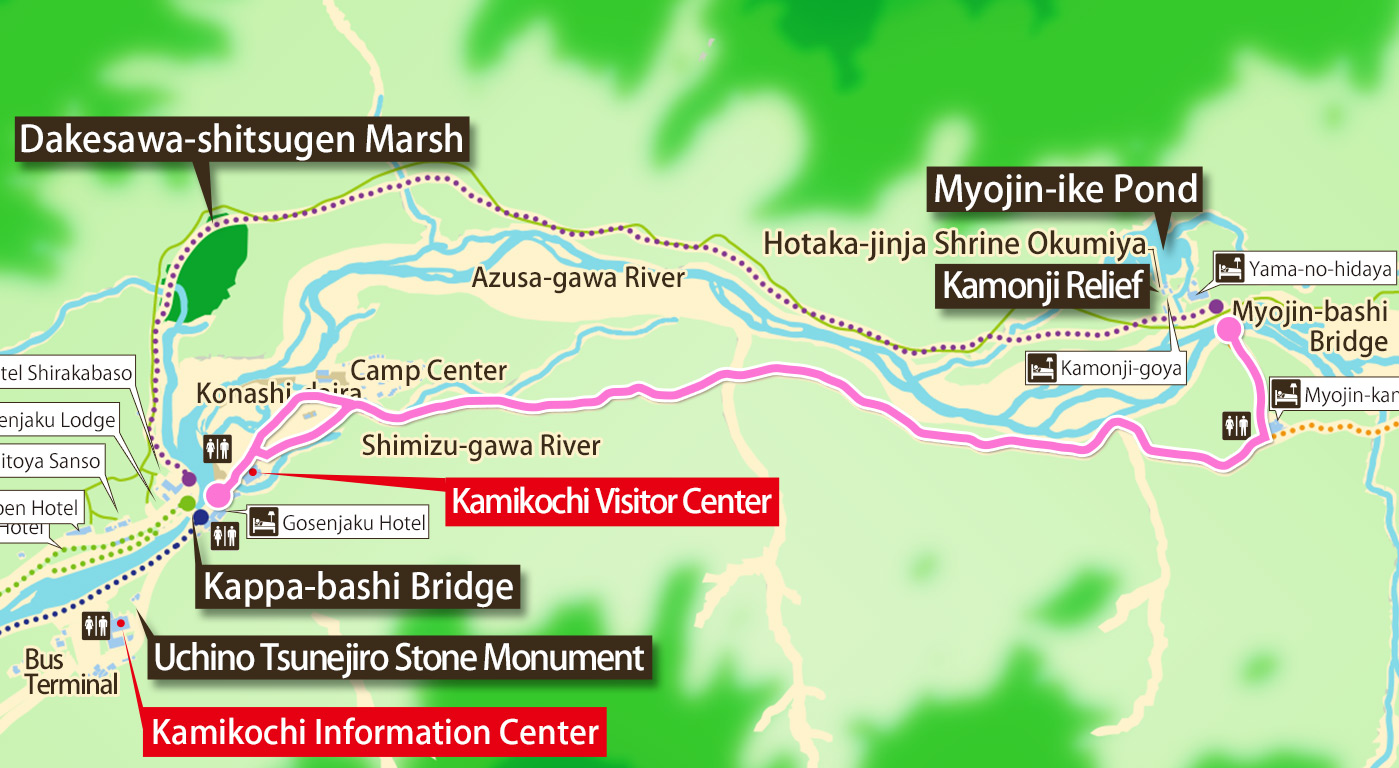
- Kappa-bashi Bridge to Myojin (Azusa-gawa River Left-shore Path)Distance: About 3.0 kmDuration: About 60 minutes
- The trail along the Shimizu-gawa River leads from Konashi-daira to the forest. You should have a view of Mt. Choga-take as you progress along this path. Soon you’ll come across traces of volcanic mud flows at Shimoshira-sawa on the bank of Azusa-gawa River. You’ll see some young plants such as willows and alders restoring the forest. Myojin is a short distance from here.
Walking Trails Latest Information
Information on the walking trails of Kamikochi.
- Kappa-bashi Bridge to Tashiro-bashi Bridge (Azusa-gawa River Left-shore Path)
- Kappa-bashi Bridge to Tashiro-bashi Bridge (Azusa-gawa River Right-shore Path)
- Tashiro-bashi Bridge – Taisho-ike Pond (Forest Path)
- Tashiro-bashi Bridge to Taisho-ike Pond (Azusa-gawa River Path)
- Kappa-bashi Bridge to Myojin (Azusa-gawa River Right-shore Path)
- Myojin to Tokusawa